
Thank you for supporting this site ❤️
Make a donation
Make a donation
Guardiaregia topographic map
Click on the map to display elevation.
Thank you for supporting this site ❤️
Make a donation
Make a donation
About this map
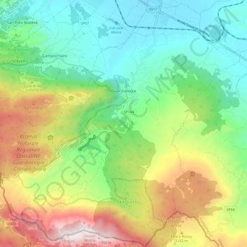
Name: Guardiaregia topographic map, elevation, terrain.
Location: Guardiaregia, Campobasso, Molise, 86014, Italy (41.37920 14.48248 41.46722 14.59714)
Average elevation: 962 m
Minimum elevation: 493 m
Maximum elevation: 1,815 m
Thank you for supporting this site ❤️
Make a donation
Make a donation