
Thank you for supporting this site ❤️
Make a donation
Make a donation
Olhão topographic map
Click on the map to display elevation.
Thank you for supporting this site ❤️
Make a donation
Make a donation
Olhão
Over time the small town of fishermen grew into an economic, social and urban centre, resulting in its elevation in city in 1985. In recent years, it has also developed a growing tourist industry.
Thank you for supporting this site ❤️
Make a donation
Make a donation
About this map
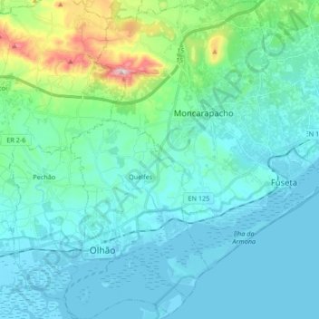
Name: Olhão topographic map, elevation, terrain.
Location: Olhão, Faro, Portugal (36.99808 -7.88977 37.13116 -7.72364)
Average elevation: 62 m
Minimum elevation: -4 m
Maximum elevation: 408 m
Thank you for supporting this site ❤️
Make a donation
Make a donation
Other topographic maps
Click on a map to view its topography, its elevation and its terrain.