
Thank you for supporting this site ❤️
Make a donation
Make a donation
Fuzhou City topographic map
Click on the map to display elevation.
Thank you for supporting this site ❤️
Make a donation
Make a donation
About this map
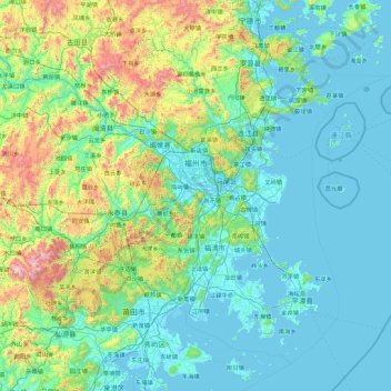
Name: Fuzhou City topographic map, elevation, terrain.
Location: Fuzhou City, Fujian, China (25.23631 118.37596 26.63844 120.19009)
Average elevation: 258 m
Minimum elevation: -4 m
Maximum elevation: 1,784 m
Thank you for supporting this site ❤️
Make a donation
Make a donation