
Thank you for supporting this site ❤️
Make a donation
Make a donation
Stow topographic map
Click on the map to display elevation.
Thank you for supporting this site ❤️
Make a donation
Make a donation
Stow
On New Year's Day, 1984, Kevin Walsh took off from Minute Man Air Field with 57 helium balloons tied to a lawn chair, later descending by parachute. He was cited with four violations of FAA regulations and fined $4,000 ($10,922.66 adjusted for inflation to 2022). He reached an altitude of 9,000 feet (2,700 m).
Thank you for supporting this site ❤️
Make a donation
Make a donation
About this map
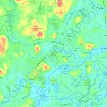
Name: Stow topographic map, elevation, terrain.
Location: Stow, Middlesex County, Massachusetts, 01775, United States (42.39003 -71.55910 42.46646 -71.46433)
Average elevation: 72 m
Minimum elevation: 50 m
Maximum elevation: 137 m
Thank you for supporting this site ❤️
Make a donation
Make a donation
Other topographic maps
Click on a map to view its topography, its elevation and its terrain.