
Thank you for supporting this site ❤️
Make a donation
Make a donation
Avondale topographic map
Click on the map to display elevation.
Thank you for supporting this site ❤️
Make a donation
Make a donation
About this map
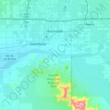
Name: Avondale topographic map, elevation, terrain.
Location: Avondale, Maricopa County, Arizona, United States (33.26128 -112.36118 33.50400 -112.27244)
Average elevation: 339 m
Minimum elevation: 261 m
Maximum elevation: 1,364 m
Thank you for supporting this site ❤️
Make a donation
Make a donation
Other topographic maps
Click on a map to view its topography, its elevation and its terrain.