
Thank you for supporting this site ❤️
Make a donation
Make a donation
Churchill topographic map
Click on the map to display elevation.
Thank you for supporting this site ❤️
Make a donation
Make a donation
About this map
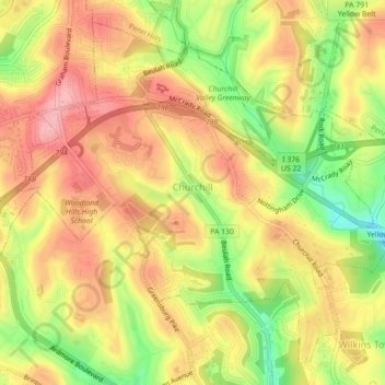
Name: Churchill topographic map, elevation, terrain.
Location: Churchill, Allegheny County, Pennsylvania, United States (40.42301 -79.86474 40.45277 -79.82073)
Average elevation: 345 m
Minimum elevation: 264 m
Maximum elevation: 403 m
Thank you for supporting this site ❤️
Make a donation
Make a donation