
Waynesville topographic map
Interactive map
Click on the map to display elevation.
About this map
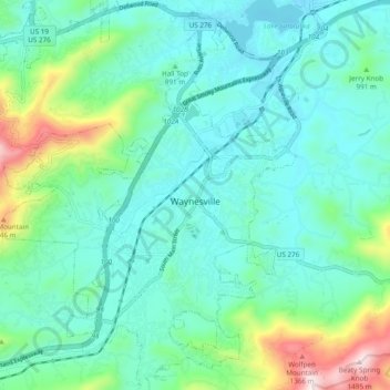
Name: Waynesville topographic map, elevation, terrain.
Location: Waynesville, Haywood County, North Carolina, 28786, USA (35.45078 -83.03764 35.52890 -82.96353)
Average elevation: 921 m
Minimum elevation: 772 m
Maximum elevation: 1,484 m