
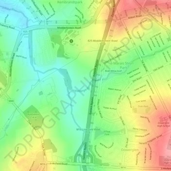
Eastleigh Spruit topographic map
Interactive map
Click on the map to display elevation.
About this map
Name: Eastleigh Spruit topographic map, elevation, terrain.
Average elevation: 1,586 m
Minimum elevation: 1,534 m
Maximum elevation: 1,646 m
Other topographic maps
Click on a map to view its topography, its elevation and its terrain.
Klipriviersberg Nature Reserve
South Africa > Gauteng > City of Johannesburg Metropolitan Municipality > Johannesburg
Klipriviersberg Nature Reserve, Ruins Trail, Johannesburg Ward 23, Johannesburg, City of Johannesburg Metropolitan Municipality, Gauteng, 2001, South Africa
Average elevation: 1,634 m
Emmarentia Dam
South Africa > Gauteng > City of Johannesburg Metropolitan Municipality > Johannesburg
Emmarentia Dam, Emmarentia, Johannesburg Ward 88, Johannesburg, City of Johannesburg Metropolitan Municipality, Gauteng, 2001, South Africa
Average elevation: 1,611 m
Chartwell Gardens
South Africa > Gauteng > City of Johannesburg Metropolitan Municipality > Johannesburg
Chartwell Gardens, Killarney, Johannesburg Ward 73, Johannesburg, City of Johannesburg Metropolitan Municipality, Gauteng, 2001, South Africa
Average elevation: 1,703 m
Rose Gardens
South Africa > Gauteng > City of Johannesburg Metropolitan Municipality > Johannesburg
Rose Gardens, Emmarentia, Johannesburg Ward 88, Johannesburg, City of Johannesburg Metropolitan Municipality, Gauteng, 2001, South Africa
Average elevation: 1,613 m