
Thank you for supporting this site ❤️
Make a donation
Make a donation
Friedrichshain-Kreuzberg topographic map
Click on the map to display elevation.
Thank you for supporting this site ❤️
Make a donation
Make a donation
About this map
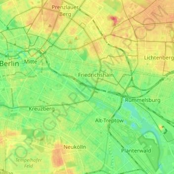
Name: Friedrichshain-Kreuzberg topographic map, elevation, terrain.
Location: Friedrichshain-Kreuzberg, Berlin, Germany (52.48279 13.36823 52.53103 13.49144)
Average elevation: 45 m
Minimum elevation: 22 m
Maximum elevation: 74 m
Thank you for supporting this site ❤️
Make a donation
Make a donation