
Roodepoort topographic map
Interactive map
Click on the map to display elevation.
About this map
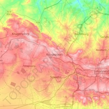
Name: Roodepoort topographic map, elevation, terrain.
Average elevation: 1,612 m
Minimum elevation: 1,346 m
Maximum elevation: 1,831 m
Other topographic maps
Click on a map to view its topography, its elevation and its terrain.
Johannesburg Ward 97
RSA > Gauteng > Roodepoort
Johannesburg Ward 97, Roodepoort, City of Johannesburg Metropolitan Municipality, Gauteng, 2040, RSA
Average elevation: 1,582 m