
Thank you for supporting this site ❤️
Make a donation
Make a donation
Augusta topographic map
Click on the map to display elevation.
Thank you for supporting this site ❤️
Make a donation
Make a donation
About this map
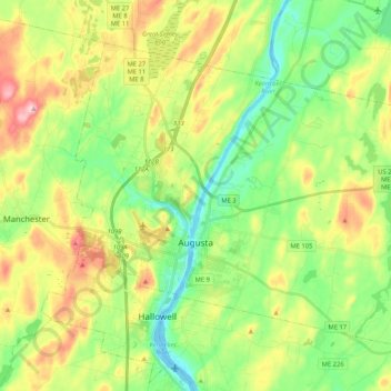
Name: Augusta topographic map, elevation, terrain.
Location: Augusta, Kennebec County, Maine, 04330, United States (44.27506 -69.83423 44.39176 -69.62570)
Average elevation: 74 m
Minimum elevation: -4 m
Maximum elevation: 193 m
Thank you for supporting this site ❤️
Make a donation
Make a donation