
Thank you for supporting this site ❤️
Make a donation
Make a donation
Distrito Guararé topographic map
Click on the map to display elevation.
Thank you for supporting this site ❤️
Make a donation
Make a donation
About this map
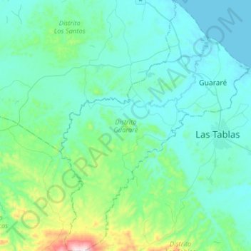
Name: Distrito Guararé topographic map, elevation, terrain.
Location: Distrito Guararé, Los Santos, Panamá (7.64819 -80.43855 7.90433 -80.24331)
Average elevation: 117 m
Minimum elevation: 0 m
Maximum elevation: 817 m
Thank you for supporting this site ❤️
Make a donation
Make a donation
Other topographic maps
Click on a map to view its topography, its elevation and its terrain.