
Thank you for supporting this site ❤️
Make a donation
Make a donation
Anqing topographic map
Click on the map to display elevation.
Thank you for supporting this site ❤️
Make a donation
Make a donation
About this map
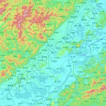
Name: Anqing topographic map, elevation, terrain.
Location: Anqing, Anhui, China (29.78396 115.75585 31.27133 117.24722)
Average elevation: 210 m
Minimum elevation: 2 m
Maximum elevation: 1,713 m
Thank you for supporting this site ❤️
Make a donation
Make a donation
Other topographic maps
Click on a map to view its topography, its elevation and its terrain.