
Chapel Hill topographic map
Interactive map
Click on the map to display elevation.
About this map
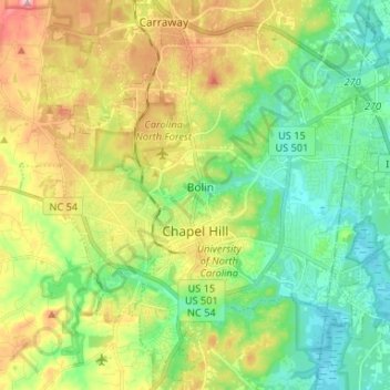
Name: Chapel Hill topographic map, elevation, terrain.
Location: Chapel Hill, Orange County, North Carolina, United States (35.86941 -79.08314 35.97614 -78.99539)
Average elevation: 126 m
Minimum elevation: 68 m
Maximum elevation: 225 m
Other topographic maps
Click on a map to view its topography, its elevation and its terrain.
High Park
United States > North Carolina > Orange County > Chapel Hill
High Park, Chapel Hill, Orange County, North Carolina, 27599, United States
Average elevation: 128 m