
Province of Lima topographic map
Click on the map to display elevation.
About this map
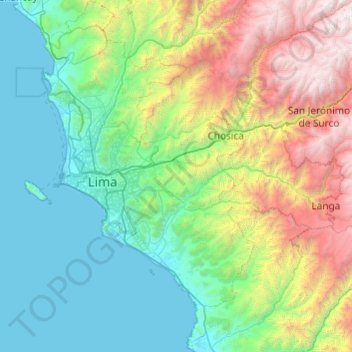
Name: Province of Lima topographic map, elevation, terrain.
Location: Province of Lima, Lima Metropolitan Area, Lima, Peru (-12.51993 -77.19921 -11.57244 -76.62082)
Average elevation: 1,234 m
Minimum elevation: 0 m
Maximum elevation: 5,203 m