
Thank you for supporting this site ❤️
Make a donation
Make a donation
Voorde topographic map
Click on the map to display elevation.
Thank you for supporting this site ❤️
Make a donation
Make a donation
About this map
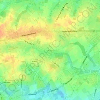
Name: Voorde topographic map, elevation, terrain.
Location: Voorde, Ninove, Aalst, East Flanders, Belgium (50.81179 3.91806 50.83939 3.96385)
Average elevation: 32 m
Minimum elevation: 12 m
Maximum elevation: 51 m
Thank you for supporting this site ❤️
Make a donation
Make a donation