
Culross topographic map
Interactive map
Click on the map to display elevation.
About this map
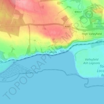
Name: Culross topographic map, elevation, terrain.
Location: Culross, Fife, Scotland, KY12 8HT, United Kingdom (56.03566 -3.64837 56.07566 -3.60837)
Average elevation: 28 m
Minimum elevation: 0 m
Maximum elevation: 97 m
Other topographic maps
Click on a map to view its topography, its elevation and its terrain.
St Andrews
United Kingdom > Scotland > Fife > St Andrews
St Andrews, Fife, Scotland, KY16 9PA, United Kingdom
Average elevation: 38 m