
Gravesend topographic map
Click on the map to display elevation.
About this map
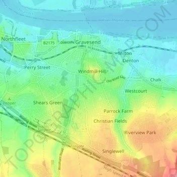
Name: Gravesend topographic map, elevation, terrain.
Location: Gravesend, Gravesham, Kent, England, United Kingdom (51.40741 0.35335 51.45201 0.43129)
Average elevation: 31 m
Minimum elevation: 0 m
Maximum elevation: 96 m