
Elmbridge topographic map
Interactive map
Click on the map to display elevation.
About this map
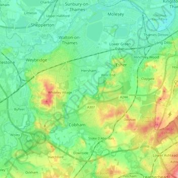
Name: Elmbridge topographic map, elevation, terrain.
Location: Elmbridge, Surrey, South East, England, United Kingdom (51.29485 -0.48122 51.41205 -0.30739)
Average elevation: 29 m
Minimum elevation: 0 m
Maximum elevation: 97 m
Other topographic maps
Click on a map to view its topography, its elevation and its terrain.
Swallowfields
United Kingdom > England > Elmbridge > Swallowfields
Swallowfields, Elmbridge, Surrey, South East, England, KT12 2YF, United Kingdom
Average elevation: 15 m