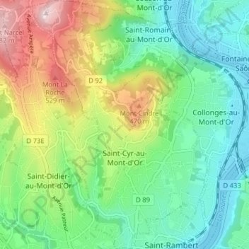
Saint-Cyr-au-Mont-d'Or topographic map
Interactive map
Click on the map to display elevation.
About this map
Name: Saint-Cyr-au-Mont-d'Or topographic map, elevation, terrain.
Average elevation: 310 m
Minimum elevation: 166 m
Maximum elevation: 605 m

Click on the map to display elevation.
Name: Saint-Cyr-au-Mont-d'Or topographic map, elevation, terrain.
Average elevation: 310 m
Minimum elevation: 166 m
Maximum elevation: 605 m