
Roosendaal topographic map
Interactive map
Click on the map to display elevation.
About this map
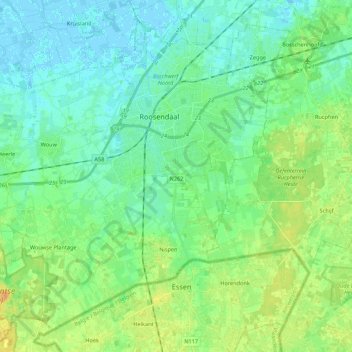
Name: Roosendaal topographic map, elevation, terrain.
Location: Roosendaal, North Brabant, Netherlands (51.45149 4.30681 51.56923 4.52319)
Average elevation: 8 m
Minimum elevation: -3 m
Maximum elevation: 24 m