
Ramela topographic map
Interactive map
Click on the map to display elevation.
About this map
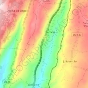
Name: Ramela topographic map, elevation, terrain.
Location: Ramela, Guarda, Beira Interior Norte, Centro, Portugal (40.44642 -7.28254 40.49381 -7.23455)
Average elevation: 797 m
Minimum elevation: 546 m
Maximum elevation: 989 m