
Great Brak River topographic map
Interactive map
Click on the map to display elevation.
About this map
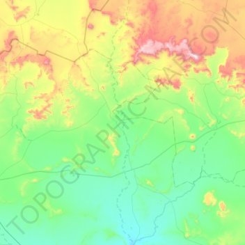
Name: Great Brak River topographic map, elevation, terrain.
Average elevation: 1,351 m
Minimum elevation: 1,100 m
Maximum elevation: 2,095 m
Other topographic maps
Click on a map to view its topography, its elevation and its terrain.
Spioenkop
South Africa > Eastern Cape > Inxuba Yethemba Local Municipality
Spioenkop, Inxuba Yethemba Local Municipality, Chris Hani District Municipality, Eastern Cape, South Africa
Average elevation: 1,336 m