
Madzombani waterpan topographic map
Interactive map
Click on the map to display elevation.
About this map
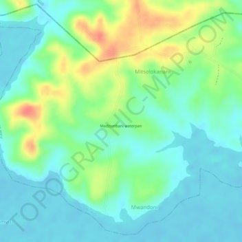
Name: Madzombani waterpan topographic map, elevation, terrain.
Location: Madzombani waterpan, Mombasa, Kenya (-3.97220 39.62970 -3.97210 39.62980)
Average elevation: 20 m
Minimum elevation: -3 m
Maximum elevation: 59 m
Other topographic maps
Click on a map to view its topography, its elevation and its terrain.
Mombasa
Being a coastal town, Mombasa is characterised by a flat topography. The town of Mombasa is centred on Mombasa Island, but extends to the mainland. The island is separated from the mainland by two creeks, Port Reitz in the south and Tudor Creek in the north.
Average elevation: 18 m