
Sidbury topographic map
Interactive map
Click on the map to display elevation.
About this map
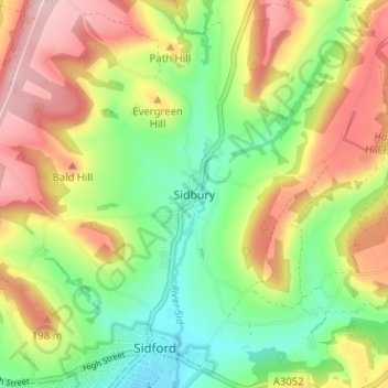
Name: Sidbury topographic map, elevation, terrain.
Location: Sidbury, East Devon, Devon, England, EX10 0SG, United Kingdom (50.69961 -3.24022 50.73961 -3.20022)
Average elevation: 128 m
Minimum elevation: 30 m
Maximum elevation: 248 m
Other topographic maps
Click on a map to view its topography, its elevation and its terrain.
Seaton
United Kingdom > England > Devon > East Devon
Seaton, East Devon, Devon, England, United Kingdom
Average elevation: 33 m