
Lambton County topographic map
Interactive map
Click on the map to display elevation.
About this map
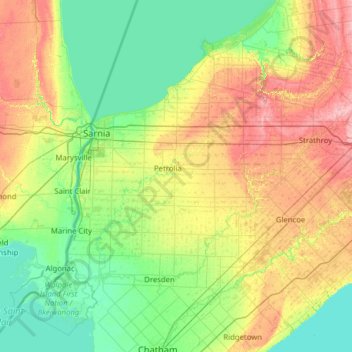
Name: Lambton County topographic map, elevation, terrain.
Location: Lambton County, Southwestern Ontario, Ontario, Canada (42.39763 -82.80365 43.31963 -81.74315)
Average elevation: 200 m
Minimum elevation: 171 m
Maximum elevation: 267 m