
Cheatham County topographic map
Interactive map
Click on the map to display elevation.
About this map
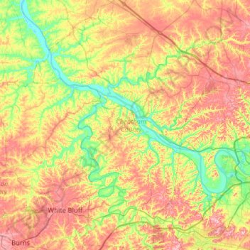
Name: Cheatham County topographic map, elevation, terrain.
Location: Cheatham County, Tennessee, United States of America (36.04131 -87.28896 36.45569 -86.90959)
Average elevation: 189 m
Minimum elevation: 113 m
Maximum elevation: 286 m
Other topographic maps
Click on a map to view its topography, its elevation and its terrain.
Johnson City
United States of America > Tennessee > Johnson City
Johnson City, Washington County, Tennessee, United States of America
Average elevation: 513 m
Wellington Park
United States of America > Tennessee > Johnson City > Wellington Park
Wellington Park, Johnson City, Washington County, Tennessee, 37604, United States of America
Average elevation: 547 m
Gatlinburg
United States of America > Tennessee > Gatlinburg > Gatlinburg
Gatlinburg, Sevier County, Tennessee, United States of America
Average elevation: 577 m