
Isiolo County topographic map
Interactive map
Click on the map to display elevation.
About this map
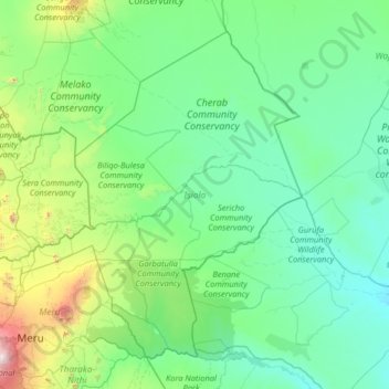
Name: Isiolo County topographic map, elevation, terrain.
Location: Isiolo County, Kenya (-0.08864 36.86512 2.09746 39.46290)
Average elevation: 466 m
Minimum elevation: 143 m
Maximum elevation: 3,859 m
Other topographic maps
Click on a map to view its topography, its elevation and its terrain.
Shaba National Reserve
Shaba National Reserve, Shaba-Nakuprat-Gotu Road, Isiolo County, Kenya
Average elevation: 852 m