
Les Eyzies topographic map
Interactive map
Click on the map to display elevation.
About this map
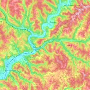
Name: Les Eyzies topographic map, elevation, terrain.
Average elevation: 157 m
Minimum elevation: 53 m
Maximum elevation: 261 m
Other topographic maps
Click on a map to view its topography, its elevation and its terrain.
Les Eyzies-de-Tayac-Sireuil
France > New Aquitaine > Les Eyzies
Les Eyzies-de-Tayac-Sireuil, Les Eyzies, Sarlat-la-Canéda, Dordogne, New Aquitaine, Metropolitan France, 24620, France
Average elevation: 159 m