
تفتان topographic map
Interactive map
Click on the map to display elevation.
About this map
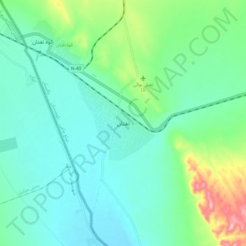
Name: تفتان topographic map, elevation, terrain.
Location: تفتان, ضلع چاغی, Baloutchistan, Pakistan (28.90950 61.54801 28.98950 61.62801)
Average elevation: 812 m
Minimum elevation: 771 m
Maximum elevation: 950 m