
Maretlwane topographic map
Interactive map
Click on the map to display elevation.
About this map
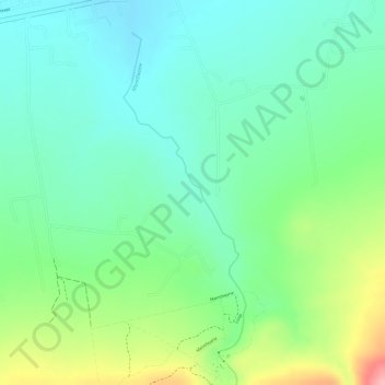
Name: Maretlwane topographic map, elevation, terrain.
Average elevation: 1,241 m
Minimum elevation: 1,196 m
Maximum elevation: 1,333 m
Other topographic maps
Click on a map to view its topography, its elevation and its terrain.
Magaliesberg Protected Natural Environment
RSA > North West > Madibeng Local Municipality
Magaliesberg Protected Natural Environment, R560, Madibeng Ward 29, Madibeng Local Municipality, Bojanala Platinum District Municipality, North West, RSA
Average elevation: 1,363 m