
Mount Tahan topographic map
Interactive map
Click on the map to display elevation.
About this map
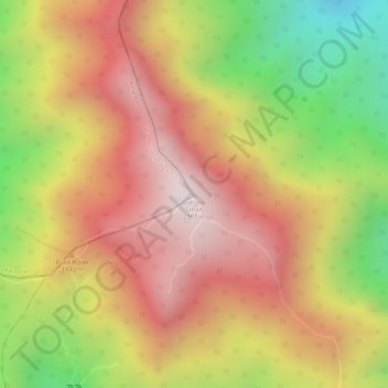
Name: Mount Tahan topographic map, elevation, terrain.
Location: Mount Tahan, Pahang, Malaysia (4.63305 102.23496 4.63315 102.23506)
Average elevation: 1,829 m
Minimum elevation: 1,349 m
Maximum elevation: 2,162 m
Other topographic maps
Click on a map to view its topography, its elevation and its terrain.
Cameron Highlands
Cameron Highlands, Pahang, 39000, Malaysia
Average elevation: 1,400 m
Malay Peninsula
Malay Peninsula, 64, Damak, Pahang, 27030, Malaysia
Average elevation: 131 m