
Mangoli topographic map
Interactive map
Click on the map to display elevation.
About this map
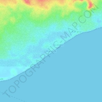
Name: Mangoli topographic map, elevation, terrain.
Location: Mangoli, Sula Islands, North Maluku, Indonesia (-1.94719 125.91772 -1.90719 125.95772)
Average elevation: 11 m
Minimum elevation: 0 m
Maximum elevation: 72 m