
Gatineau topographic map
Interactive map
Click on the map to display elevation.
About this map
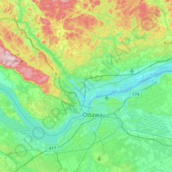
Name: Gatineau topographic map, elevation, terrain.
Location: Gatineau, Outaouais, Quebec, Canada (45.37238 -75.90835 45.59912 -75.34437)
Average elevation: 128 m
Minimum elevation: 39 m
Maximum elevation: 409 m