
Harding topographic map
Interactive map
Click on the map to display elevation.
About this map
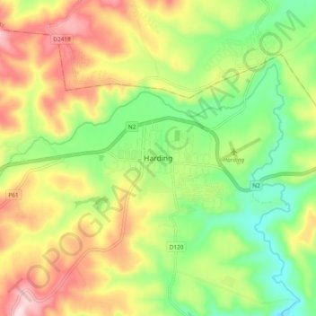
Name: Harding topographic map, elevation, terrain.
Average elevation: 878 m
Minimum elevation: 726 m
Maximum elevation: 1,072 m
Other topographic maps
Click on a map to view its topography, its elevation and its terrain.
Weza Forest
South Africa > KwaZulu-Natal > Ugu District Municipality > uMuziwabantu Local Municipality
Areas of forest which grow in KwaZulu-Natal, South Africa mostly on south facing slopes in higher rainfall areas, and along the humid coastal areas. Different types of forest can be identified by their species composition which depends mostly on the altitude, latitude and substrate (soil and rock types) in…
Average elevation: 1,317 m