
Vredenburg topographic map
Interactive map
Click on the map to display elevation.
About this map
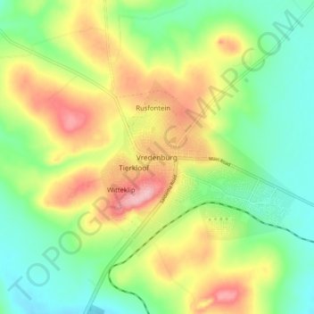
Name: Vredenburg topographic map, elevation, terrain.
Average elevation: 91 m
Minimum elevation: 28 m
Maximum elevation: 183 m
Other topographic maps
Click on a map to view its topography, its elevation and its terrain.
Saldanha Bay Ward 7
South Africa > Western Cape > West Coast District Municipality > Saldanha Bay Local Municipality
Average elevation: 69 m