
McGregor topographic map
Interactive map
Click on the map to display elevation.
About this map
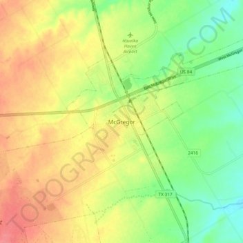
Name: McGregor topographic map, elevation, terrain.
Location: McGregor, McLennan County, Texas, 76657, United States (31.39670 -97.44809 31.47670 -97.36809)
Average elevation: 218 m
Minimum elevation: 186 m
Maximum elevation: 248 m