
Cooper's Cave topographic map
Interactive map
Click on the map to display elevation.
About this map
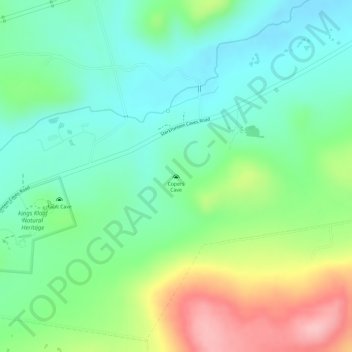
Name: Cooper's Cave topographic map, elevation, terrain.
Average elevation: 1,479 m
Minimum elevation: 1,422 m
Maximum elevation: 1,583 m
Other topographic maps
Click on a map to view its topography, its elevation and its terrain.
Coronation Park
South Africa > Gauteng > West Rand District Municipality > Krugersdorp
Coronation Park, Mogale City Ward 14, Krugersdorp, Mogale City Local Municipality, West Rand District Municipality, Gauteng, South Africa
Average elevation: 1,737 m