
Soada Forest Nature Reserve topographic map
Interactive map
Click on the map to display elevation.
About this map
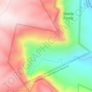
Name: Soada Forest Nature Reserve topographic map, elevation, terrain.
Average elevation: 881 m
Minimum elevation: 517 m
Maximum elevation: 1,205 m
Other topographic maps
Click on a map to view its topography, its elevation and its terrain.
Ingwe Local Municipality
RSA > KwaZulu-Natal > Ingwe Local Municipality
Ingwe Local Municipality, Sisonke District Municipality, KwaZulu-Natal, RSA
Average elevation: 1,268 m