
Chalumna River topographic map
Interactive map
Click on the map to display elevation.
About this map
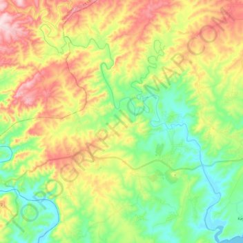
Name: Chalumna River topographic map, elevation, terrain.
Average elevation: 144 m
Minimum elevation: -1 m
Maximum elevation: 357 m
Other topographic maps
Click on a map to view its topography, its elevation and its terrain.
Nahoon River
RSA > Eastern Cape > East London
Nahoon River, East London, Buffalo City Metropolitan Municipality, Eastern Cape, RSA
Average elevation: 53 m
Buffalo City Ward 29
RSA > Eastern Cape > East London
Buffalo City Ward 29, East London, Buffalo City Metropolitan Municipality, Eastern Cape, RSA
Average elevation: 179 m