
Bhubaneshwar topographic map
Interactive map
Click on the map to display elevation.
About this map
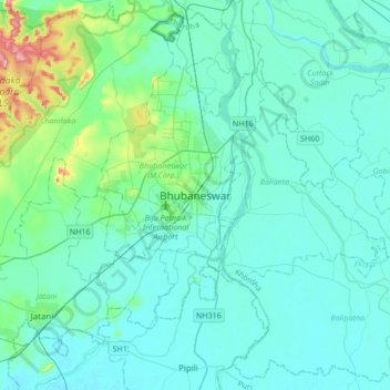
Name: Bhubaneshwar topographic map, elevation, terrain.
Location: Bhubaneshwar, Khordha, Odisha, 751001, India (20.10029 85.67945 20.42029 85.99945)
Average elevation: 30 m
Minimum elevation: 6 m
Maximum elevation: 199 m