
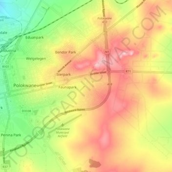
Polokwane Ward 20 topographic map
Interactive map
Click on the map to display elevation.
About this map
Name: Polokwane Ward 20 topographic map, elevation, terrain.
Average elevation: 1,316 m
Minimum elevation: 1,222 m
Maximum elevation: 1,400 m
Other topographic maps
Click on a map to view its topography, its elevation and its terrain.
Polokwane Ward 6
RSA > Limpopo > Polokwane Local Municipality
Polokwane Ward 6, Polokwane Local Municipality, Limpopo, RSA
Average elevation: 1,302 m