
Sorbonne topographic map
Interactive map
Click on the map to display elevation.
About this map
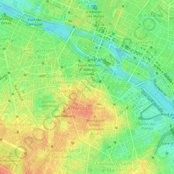
Name: Sorbonne topographic map, elevation, terrain.
Average elevation: 50 m
Minimum elevation: 26 m
Maximum elevation: 74 m
Other topographic maps
Click on a map to view its topography, its elevation and its terrain.
Montparnasse
France > Ile-de-France > Paris
Montparnasse, 14th Arrondissement, Paris, Ile-de-France, Metropolitan France, 75014, France
Average elevation: 61 m