
Branston and Mere CP topographic map
Interactive map
Click on the map to display elevation.
About this map
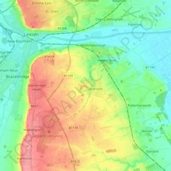
Name: Branston and Mere CP topographic map, elevation, terrain.
Average elevation: 32 m
Minimum elevation: -1 m
Maximum elevation: 85 m
Other topographic maps
Click on a map to view its topography, its elevation and its terrain.
Thorpe on the Hill
United Kingdom > England > North Kesteven > Thorpe on the Hill
Thorpe on the Hill, North Kesteven, Lincolnshire, East Midlands, England, LN6 9BQ, United Kingdom
Average elevation: 17 m