
Fakaofo topographic map
Interactive map
Click on the map to display elevation.
About this map
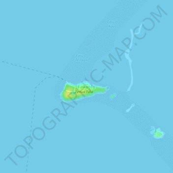
Name: Fakaofo topographic map, elevation, terrain.
Location: Fakaofo, Tokelau (-9.39430 -171.28454 -9.35430 -171.24454)
Average elevation: 0 m
Minimum elevation: 0 m
Maximum elevation: 16 m
The island was named Bowditch (after Nathaniel Bowditch), this island was visited by the American ship USS Peacock (1813) which was part of the first American voyage of discovery – The United States Exploring Expedition (also known as "the Ex Ex" or "the Wilkes Expedition"), 1838–1842, United States Navy Lieutenant Charles Wilkes commanding. Nathaniel Bowditch (1773–1838) was a noted American navigator who wrote a famous two-volume encyclopedia of navigation and sailing that is still used and published today by the Defense Mapping Agency Topographic Center (DMATC). In "Twenty Years Before The Mast", Charles Erskine wrote "The people found on this island had no knowledge of fire, which I believe, is the only instance of the kind on record." (This book should not be confused with another book with a similar title by Richard Henry Dana Jr., which tells about hide trading on the California coast in the early 19th century.)