
Saint Philip topographic map
Interactive map
Click on the map to display elevation.
About this map
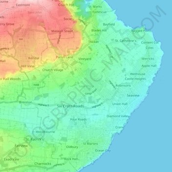
Name: Saint Philip topographic map, elevation, terrain.
Location: Saint Philip, Barbados (13.07863 -59.50947 13.18039 -59.42012)
Average elevation: 61 m
Minimum elevation: 0 m
Maximum elevation: 244 m