
Banning topographic map
Interactive map
Click on the map to display elevation.
Banning
Banning's elevation is approximately 2,300 feet (700 m) above sea level, which gives it a cooler climate in contrast to the county seat of Riverside at 800 feet (240 m) above sea level and the Coachella Valley of the Colorado Desert to the east.
About this map
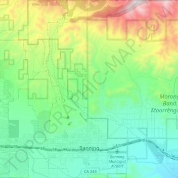
Name: Banning topographic map, elevation, terrain.
Average elevation: 1,036 m
Minimum elevation: 531 m
Maximum elevation: 2,331 m