
Makira topographic map
Interactive map
Click on the map to display elevation.
About this map
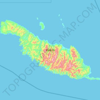
Name: Makira topographic map, elevation, terrain.
Location: Makira, Makira-Ulawa Province, Solomon Islands (-10.85098 161.26700 -10.18876 162.37895)
Average elevation: 56 m
Minimum elevation: -1 m
Maximum elevation: 1,013 m
Other topographic maps
Click on a map to view its topography, its elevation and its terrain.
Uki
Solomon Islands > Makira-Ulawa Province
Uki, Makira-Ulawa Province, Solomon Islands
Average elevation: 18 m