
Beaver County topographic map
Interactive map
Click on the map to display elevation.
About this map
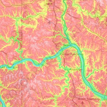
Name: Beaver County topographic map, elevation, terrain.
Location: Beaver County, Pennsylvania, United States (40.47717 -80.51934 40.85414 -80.14483)
Average elevation: 325 m
Minimum elevation: 201 m
Maximum elevation: 414 m
Other topographic maps
Click on a map to view its topography, its elevation and its terrain.
Lights Dam
United States > Pennsylvania > Lebanon County > North Lebanon Township > Ebenezer
Average elevation: 168 m
Osborn
United States > Pennsylvania > Mercer County > Salem Township > Osborn
Average elevation: 405 m
Hawk Run
United States > Pennsylvania > Clearfield County > Morris Township > Hawk Run
Average elevation: 455 m
Copesville
United States > Pennsylvania > Chester County > East Bradford Township
Average elevation: 92 m