
Oxford County topographic map
Interactive map
Click on the map to display elevation.
About this map
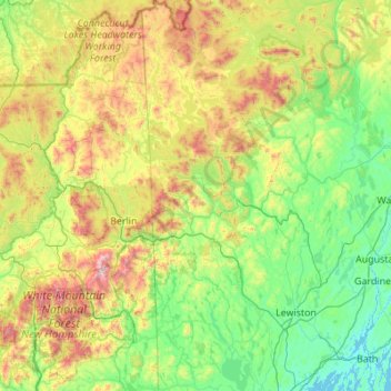
Name: Oxford County topographic map, elevation, terrain.
Location: Oxford County, Maine, United States of America (43.78499 -71.08417 45.34768 -70.23916)
Average elevation: 376 m
Minimum elevation: -2 m
Maximum elevation: 1,862 m
Other topographic maps
Click on a map to view its topography, its elevation and its terrain.
Piscataquis County
United States of America > Maine
Piscataquis County, Maine, United States of America
Average elevation: 310 m